This article provides a comprehensive overview of the current tropical disturbance, highlighting its potential development, the importance of preparedness, and the broader context of the 2024 hurricane season.
Orlando, FL – As the Atlantic hurricane season reaches its peak, meteorologists are closely monitoring a new tropical disturbance that has the potential to develop into a significant storm. This disturbance, currently located in the central Atlantic, has shown signs of organization and could pose a threat to various regions if it continues to intensify.
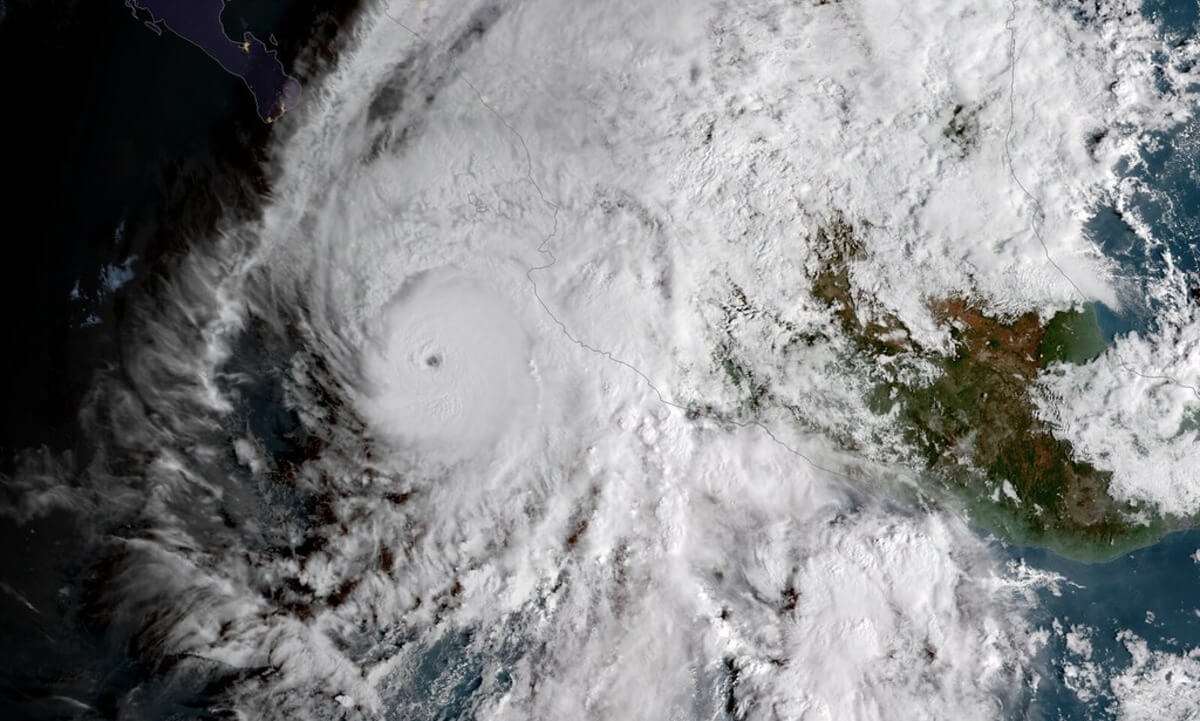
Current Situation and Forecast
The National Hurricane Center (NHC) has identified the disturbance as Invest 98L. Located several hundred miles east of the Lesser Antilles, this system is moving west-northwestward at about 15 mph. As of the latest advisory, the NHC has given Invest 98L a 70% chance of developing into a tropical depression or storm within the next 48 hours.
Meteorological Analysis
Invest 98L is currently situated in an environment that is conducive to further development. Sea surface temperatures are warm, ranging between 28 to 30 degrees Celsius, providing the necessary heat energy to fuel the system. Additionally, wind shear, which often inhibits storm development, is relatively low in the area, allowing for the disturbance to maintain and potentially increase its organization.
Satellite imagery has shown an increase in convection around the system’s center, a key indicator of a developing tropical cyclone. If these trends continue, the disturbance could strengthen into a named storm within the next few days. The next name on the Atlantic hurricane list for 2024 is Debby.
Potential Impact and Preparedness
While it is too early to determine the exact path and potential impact of Invest 98L, residents in the Lesser Antilles, Puerto Rico, and the southeastern United States are advised to monitor updates from the NHC and local weather authorities. Early forecasts suggest that if the system develops further, it could follow a path that takes it near or over parts of the Caribbean and potentially towards the Gulf of Mexico or the southeastern U.S. coast.
In preparation, it is essential for residents in these areas to review their hurricane preparedness plans. This includes ensuring that emergency supplies, such as water, non-perishable food, medications, and batteries, are stocked and that evacuation routes are planned.
Comparisons to Past Storms
This potential development comes on the heels of Hurricane Debby, which made landfall earlier this season. Debby caused significant damage in parts of the Caribbean and the southeastern United States, highlighting the need for vigilance and preparedness as the hurricane season progresses.
Meteorologists have noted similarities between Invest 98L and other historical systems that have followed similar paths and developed into major hurricanes. While it is too early to predict the ultimate intensity of Invest 98L, the comparison underscores the importance of close monitoring and early preparation.
Climate Factors and Trends
The 2024 hurricane season has been notably active, with several named storms already impacting various regions. Climate scientists attribute the heightened activity to several factors, including warmer-than-average sea surface temperatures and a persistent La Niña pattern, which tends to reduce wind shear in the Atlantic basin, thereby promoting storm development.
Long-term trends also suggest an increase in the frequency and intensity of tropical cyclones due to climate change. Warmer ocean temperatures provide more energy for storms, while higher atmospheric moisture content can lead to heavier rainfall and increased flooding risks.
Community Response and Support
In light of the potential threat, local governments and community organizations are mobilizing resources to support residents in preparing for the possibility of a significant storm. Information sessions, distribution of emergency supplies, and updates via social media and local news outlets are part of the coordinated effort to ensure public safety.
Conclusion
As Invest 98L continues to develop in the central Atlantic, the situation serves as a reminder of the importance of vigilance and preparedness during the hurricane season. Residents in potentially affected areas should stay informed through reliable sources, follow guidance from local authorities, and take proactive steps to safeguard their families and properties. The coming days will be crucial in determining the path and intensity of this system, and ongoing monitoring will be essential for timely and effective response efforts.
For the latest updates, visit the National Hurricane Center’s website or follow local weather news outlets.